
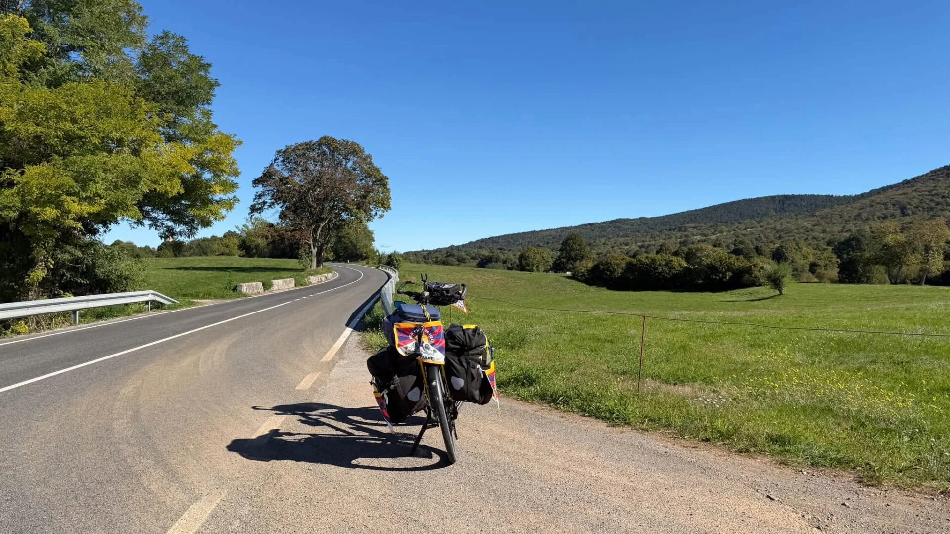
Around the Adriatic Sea 2026: Trieste – Dubrovnik
All photos: Balkan photos, city photos. The photos of the cycle route are listed in reverse chronological order. Those of the cities are listed chronologically.

The hills gradually become mountains: fewer kilometres because of more altimeters and longer climbs.
Monday, Aug 29: Bourges - Néret (67.1 km - 620 altimeters)
Today there was just under 70 km on the menu, the first 30 slightly undulating and thus fast, the last 40 with more climbing.
To Chateauneuf-sur-Cher So it went pretty smoothly.Just as well, because the landscape was monotonous: vast sun-drenched-sun scorched fields and more fields, virtually without trees nor shade. Fortunately, the temperature was still manageable at the time. Chateauneuf has a pretty little basilica, but it was closed.
That was the last medium-sized town before I headed into the French countryside. The last opportunity to forage before tonight. The extra food weight had to be pedalled over the hills with me, hurrah.
From Chateauneuf the route was on single-lane roads with the accompanying heavier climbing, but fortunately I never had to push the bike. However, there were long stretches where I was only moving at 6 km/hour, which lowered my average speed considerably.
At Ineuil, a small village with nearby remains of a Roman camp, I had lunch on a bench behind the simple, 11-13th-century church. I also went there for half an hour horizontally, as the toughest part of my stage was yet to come.

In the afternoon, I started to feel some heat (33 degrees) anyway. The course was much more varied now with more turns, but there were still few trees. And after hours in the full sun, my supply of drinking water was warm. That makes you a bit glum in the long run.
Towards the end, Komoot also sent me along some rough gravel roads that I did not dare to cycle on with my poor little second-hand bike. I walked a total of about two kilometres, but actually that does some good for a change. Fortunately, there were no steep sections so it bike push was not heavy.
Beyond Touchay I descended to the bed of the Arnon river. Turned out the roadway there runs right through the river. A footbridge saved me wet feet.
Just before Camping Le Bonhomme I passed a meadow with cows in the company of quite a few snow-white, slender birds. The same birds, I seem to remember, as those that live symbiotically with water buffaloes in India. Who knows what they are called?
Camping Le Bonhomme at Néret is operated by Jan and Jacqueline Broekmaat. You hear, a Dutch couple. I have camped a lot in the Netherlands. After the French municipals with peeling walls and cobwebs all over the sanitary facilities, it was like coming home, in that typical Dutch cleanliness and cosiness, with soft music in the sanitary facilities and discreet candle lanterns on the campsite in the evening. A campsite full of greying Dutch people, they know how to find each other. When I arrived, they were still working on their communal afternoon drinks from five o'clock. On arrival, Jacqueline offered me a fresh iced tea, heavenly after all the hot tap water.
In short, a quiet, cosy campsite and - finally - good wifi. This is where I hang out for a while. The nearest food shop is 12 km from here, when I run out of food I have to move on.
Wednesday, Aug 31: Néret - Guéret (65, 2 km - 1010 altimeters)
A 62 km trek with 900 altimeters indicated the Komoot route planning for today. Pretty tough because of those elevation gains. And it ended up being 1010.
The campsite is on a lake a little way past town. I knew that the last 8 km to Guéret were still going to rise sharply, but once past the centre I expected a descent down to the lake. That was another miscalculation: it kept going up all the way to the campsite gate. The pond was apparently above the city....
Those last, unexpected climbing kilometres were suddenly too much, sucking the last energy and strength out of my body. Just goes to show how unfulfilled expectations suddenly cut off your legs. If I had calculated that climb in advance, it wouldn't have felt so tough, I'm convinced. Soite, I got there, but first I got a little 'crashed' (lie down) before setting up the tent and starting dinner.
By the way, the ride itself was beautiful. Almost all of the route was on single-lane roads.
At Saint-Sévère-sur-Indre it was market. Next to the market square is the 'Maison de jour de fête' museum, about the first burlesque feature film by Jacques Tati. The entrance to the museum is the carefully recreated post office of François le facteur. During the war, Tati stayed in this village and shot his first print there in 1947. The museum tells the story of those sometimes hilarious shots. The presentation lasts an hour. Knowing that a tough ride awaited me and that I had to report to the campsite before seven, I didn't dare take that time. A pity, because it seemed worthwhile. The cosy little museum exuded a cool nostalgic 1950s atmosphere.

After a long and hard climb, I descended to the village of Jouillat, which boasts a medieval castle and a small church from the 11-12th century. The little church was open. Wonderfully cool to take a breather after this tiring part of the ride.
The last pretty village before Guéret was Glenic. There was also a very special fortified church from the 11-12th century: Church of the Nativity of the Virgin Mary. It was built on top of an ancient Gallo-Roman temple and some elements, such as an epitaph and some tombstones and granite blocks, are still in the architecture. The inscription on the epitaph is by a Roman who had a tomb built for his wife, father, daughter and himself. A provident man.
Thursday, Sept 1: Guéret - Banize (38.1 km - 460 altimeters)
After the 'physical crash' last night as a result of the many and steep climbs, I planned my route today according to the number of altimeters: no more than 500! That was a wise decision, as my leg muscles were clearly not yet fully recovered. Muscle acidification on exertion occurred faster than usual. From here on in route planning, I will take the number of altimeters as the first criterion, before the number of kilometres.
At Banize is a youth hostel where I can stay for 15 euros/night and tomorrow is predicted to be an 80% rainy day with thunderstorms here, so that will be a comfortable day of rest 'under roof'.
The person in charge of the youth hostel had warned me that there were no more 'commerces' here and that I had to provide provisions on the way. According to GoogleMaps, there was not a single food shop on the nearly 40 km of Guéret to Banize, so I had to descend back to the city centre to stock up on food for 2 days. Afterwards, this indeed turned out to be true: not a single shop or café/restaurant on the whole of that route. The closest Proxy here is in Royère, 15 km past Banize. That's where I'll have to stop first on Saturday to avoid running out of provisions....

Once the long climb out Guéret behind, I found myself in a beautiful landscape, but quite heavily hilly - you can already speak of mountains here as they go above 700 metres - but the views more than compensated for the climbing pains.
So you won't find pubs to cool down here, but most village churches are open. After about two hours' toil, I was able to rest and cool off in the little church of Maisonisses, dating from the 12-13th century. During that period, many little churches were apparently built in these parts. A Templar commandery have been those established by 'Hospitaliers' of the order of John the Baptist. These were simultaneously monk, nurse and soldier. The church also contained a Templar sarcophagus. The church was built on a crypt dedicated to John the Baptist, which can also be entered from the outside (south side of the church). Cool that you can enter all this unguarded. Here, people still trust their fellow human beings.
When I took a breath in the square of Saint-Georges-la-Pouge the village school was just out and some parents were busy talking to the trio of teachers at the school about their offspring's first day at school
I noticed that the landscape here is suddenly much greener again and the trees have not yet started to go into 'autumn mode'. At Camping Le Bonhomme, barely 100 km from here, there were still drought cracks in the camping area and the meadows looked reddish. Either falls here in nature reserve Millevaches and Limousin more rain, or the soil holds moisture better. Who will tell me?
September 2-3: rest day Banize and drive to Tarnac (40.7 km - 710 altimeters)
The rest day at Banize's comfortable youth hostel did me good. Besides, I was alone there all day, no fuss about it. The WiFi was good and I was able to update well. And I escaped four violent showers with hail. Devil's fair.
When I returned from an evening walk, a couple had arrived. Eighty-somethings on their way from Brittany to the Cévenne for a week's holiday. Without smartphones or GPS, but with the good old Michelin maps. A sturdy couple, nice to grow old together like this. With all their ailments of old age, they had a good laugh. How I love that!
They carried several coolers with supplies and treated me to a glass of kir. That tasted great after a whole day of tea or tap water.
On Saturday, I first had to visit La Royère-en-Vassivière pass by to stock up on food. The shop closes between 12:30-15:30, so I had to arrive there around noon. On Komoot I saw that it would be uphill almost all the time via those small, steep, rural lanes. In terms of leg muscle acidification, I went into the red a few times again and one time I couldn't help but just push my bike. Not cool.
At one point, when I saw the D7 to Royère had to cross, I decided to keep following it. I can handle the gradients on the slightly larger D roads, I never have to chase my legs into the red there. And over 10 km I didn't encounter 10 cars. Quite pleasant cycling on those routes.
At Royère there was not only a Proxy, but also a bakery, butcher and a cool Bar-Resto with tasty local dishes. Suddenly too much of a good thing, but I'm not complaining. On the contrary, very cosy.
The little church was again worth seeing. Here, upon entering the nave, a light installation even jumped on that shone coloured light on the vaults. I am really becoming a fan of these little churches here.
After Royère followed a descent to the lake of Vassivière, which was quite low. To Faux-la-Montagne - also a picturesque village - went gently undulating alongside the lake. I rode very slowly to enjoy this relatively flat stretch for longer.
But after Faux I had to hit it again for a long but manageable climb. At the highest point - a col I dare not call it yet - I passed from the Department of Creuze to Corrèze. This was to be celebrated with a very long descent, unfortunately not down into Tarnac. The first was to add half a kilometre of steep uphill, which is all the more difficult after a long descent.
On the Camping Municipal de l'Enclose in Tarnac no one was there and I had to call. That didn't work, I had noticed all along the route that I had no mobile data anywhere on my new iPhone, not even in the villages. 'No service'.
Strange, France couldn't be that backward, could it? Indeed not. After a reboot, I had coverage again. Stupidly, I had never looked on my good old Android phone, which I now use with a charge card to navigate. That one did have range. I now have some experience with both operating systems and still prefer Android. The iPhone often crashes, e.g. also with Facebook Live videos. Then my old faithful helps me out. As far as I'm concerned, iPhone is seriously overrated. And my Android is also five years old now, and it still works.
When I saved the cycled route, I noticed that I still had more than 700 altimeters in my legs. But on the D routes, these were not too bad. That inspires confidence. I'm going to leave the Komootstra patches on small inner roads for what they are. For the real sports cyclists....

Sunday, Sept 4: Tarnac - Saint-Salvadour (52 km - 620 altimeters)
It was a lazy morning on the Camping Municipal de l'Enclose in Tarnac. The tent was soaking wet with dew, my stuff inside was even a bit clammy. So I took my time and let everything dry at my leisure. The route to the large lake of Viam was well to do, the landscapes were as beautiful as the previous days and the light brown horned supporters were good-natured, although Limousin cows would be an aggressive breed. There was still a barbed wire between us.
At Viam was another restaurant, Chez Sandra. I've been very lucky the last few days! Sandra had a three-course daily menu for 22€, which I did not pass up. Honest cuisine with local produce. When I handed her a flyer, she asked for a package to put in her case. Very nice.
The small church of Viam had abstract stained-glass windows that created special lighting effects with no electricity involved.
At Lake Viam is also a camping municipal. Wonderful location, methinks, but I had to move on.
From Viam to Treignac it was 13 km of almost non-stop gentle downhill, a 'cyclist's delight'. Flames at 25-30 km per hour. But then came another serious kink in the course. To get to the centre of the town it was first a dive down to an old bridge over the Vézère, and on the other side, of course, just as steeply back up. I could also have followed the ring road around the city, but the panoramas of the city were worth the effort.
I did both slopes on foot. The dive ran over a paved macadam (tarmac) with lots of potholes and pebbles. I did not dare adventure that. And the ascension on the other side was of course stumble-pushing out of necessity. Behind me came three English men. I thought they would give my bike a push to the top with me, but they were no gentlemen. They walked past me deadpan. When I saw them sitting on a wall upstairs a little later, I wanted to say 'Thanks for helping me', but I left it at that.
After Treignac followed as expected a long slow climb over about three kilometres. It then went smoothly undulating to Lonzac. I saw an arrow pointing to a municipal at 600 metres and drove there. It was already 17:30, time to stop. Closed and there was no water coming out of the taps either, so I couldn't stay as my water was running low.
Then only 10 km further to Saint-Salvadour. It is open until 30 Sep, according to the website. The campsite was deep in a valley by a small lake, so I asked some villagers if it was definitely open. "Oui Oui", settle in and someone will come by tomorrow morning. "Non non", when I arrived everything was shut tight. Fortunately, water was still coming from an outdoor tap, so I could stay. It was also approaching 7pm by now.
My powerbank was charged and I can also use my laptop as a powerbank. That's not too bad. It will be a quiet and dark night on the abandoned Camping municipal of Saint-Salvadour.

Monday, Sep 5: Saint-Salvadour - Brives-la-Gaillarde (42.2 km - 500 altimeters)
What an off day today! I didn't make any progress. However, it was not a hard ride: just over 40 km and more descending (750m) than ascending (500m). Almost all the time on the D44, a two-lane road.
The first climb out of the campsite valley was steep but it was still manageable. For Seilhac followed another one like that, and after that my legs felt like flannel.
In Seilhac, I took a long rest in the comfortable 'Café de la poste' with good wifi to update, but that did not bring much relief to the weak physical condition. When I got back on the road, I immediately felt that the rather gentle climbs did not suit me compared to previous days.
At the height of Sainte-Féréole, 8 km before Brive, the lights went out for me for a while. I did not find a bench along the D44, so I installed my Helinox chair under an apple tree and took a long comatose break in the shade. It was hot (35°) and I had hardly had any shade on the D44.
After a long rest, I really had to grab myself by the neck to tackle the final stretch. According to GoogleMaps, it was completely downhill, but that app is never accurate when it comes to altimeters. Thank God it was now. After 300 more climbing metres, it was fast downhill for 6 km and then 2 km flat.
I suspect I had a mild heat stroke. On driving into Brives I saw a Lerclerc hypermarket and decided to see if they had campingaz water bottles. After 15 minutes of strolling around the chilled hypermarket in search of that item, I already felt the exhaustion lessening. The last two flat kilometres to Brives centre fell reasonably well after that.
The youth hostel of Brives is definitely closed, so I drove to the Tourist Info to inquire about budget hotels. Today and tomorrow I want to sleep in a bed. The cheapest hotel (24€/night incl. breakfast) turned out to be Grottes de Sainte-Antoine, 2 km away. I called and they still had room.
Turned out this was another "monastery hôtellerie" To be at a pilgrimage site with a grotto. From the Franciscan Order. The way there was another more than a kilometre of steep climbing - a bit of descent is part and parcel of pilgrimages - but with the final destination and a bed and shower in sight, it worked out.
The hôtellerie Located in a quiet park. I immediately booked for three nights with dinner. A good recovery and then back at it. There are still mountain stages to come....
In terms of photos, the D44 offered nothing that can match the landscapes of the past few days. So tonight I took a walk to the highest point of the monastery garden and took a few photos along the way.
Tomorrow it will be +30 degrees here again with 80% rain chances. After that, the temperature drops back below 30. Whew!
All photos: Balkan photos, city photos. The photos of the cycle route are listed in reverse chronological order. Those of the cities are listed chronologically.
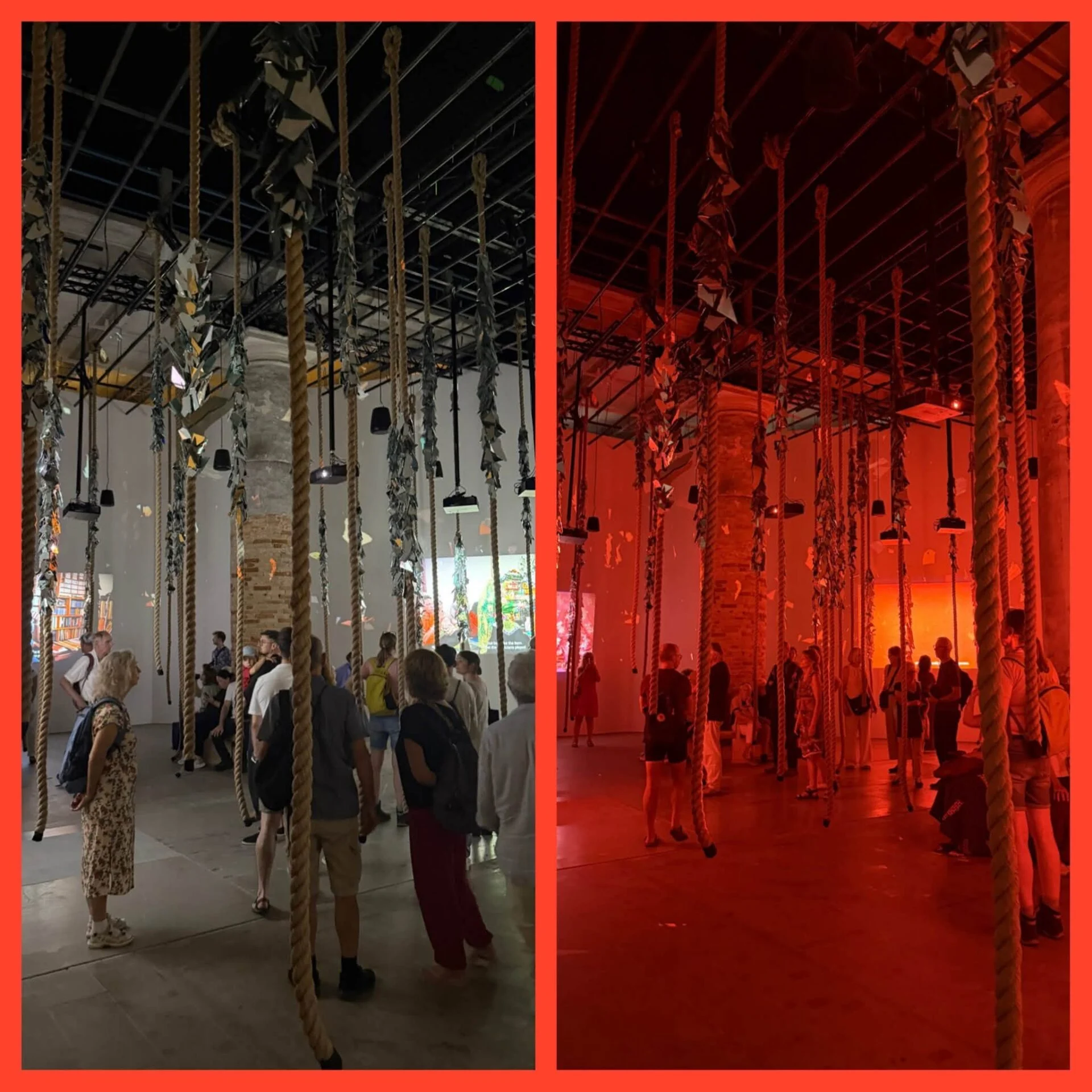
In Venice, I visited the Biennale at the Arsenale, the Giardini and various venues around the city. I also took the opportunity to see the Pinault collection at Punta della Dogana and a compelling exhibition by Michael Armitage at Palazzo Grassi.


