Around the Adriatic Sea 2026: Trieste – Dubrovnik
All photos: Balkan photos, city photos. The photos of the cycle route are listed in reverse chronological order. Those of the cities are listed chronologically.
From the Franciscan monastery in Brives to UNESCO world heritage site Rocamadour, and then via the hilly Causses de Quercy nature reserve and the beautiful valleys of the Célé and the Lot towards Carcassone.
7-8-9 Sept '22: Brives-la-Gaillarde - Meyronne (38km, 510 altimeters) - Rocamadour (12km -210 altimeters)
Wednesday 7 Sept: After my visit to the Edmond-Michelet museum, I wandered through Brives for a while: photos of street scenes and of the Collegiale Saint-Martin church, with a maria statue with an unusual facial expression and an odd altar.
Thursday, Sept 8: Meyronne
The first 20 km were mainly via hellishly steep, unnumbered shortcuts. I barely made any progress. After every tough climb, a steep descent on a paved road surface. Care had to be taken! The roads flirted with the A20 motorway all the time.
When I finally got back on the D33, I was able to grind some more kilometres at a higher speed.
Meyronne is a pretty village where the grapes and fresh figs almost literally fall into your mouth.
Friday 9 Sept: to Rocamadour
The first 4 km were flat as a billiard cloth. That was already from the Rhone Valley ago! Then a steep climb with 200 metres difference in altitude over about two kilometres to the hamlet Mayrinhac. I did that incline in three times, with two short rest breaks. I noticed that I could keep up the climb longer after each rest, as if my legs were getting used to the constant effort.
Mayrhinhac is an authentic hamlet. I had a fairly long lunch and photo stop there. There would have been habitation from before Roman times as there are several springs nearby.
The little church (12-13th century) was very special. A rectangular space with no side aisles or chapels. The entrance was not at the front, but through a discreet little door on the left. To get there, you had to descend around the church through a corridor about 1.5 metres wide. At first I thought this was the entrance to a crypt, but no, it was the main entrance to the church.
There was a magnificent undated - I estimate early Romanesque - wooden statue of the Virgin Mary. In a mossy crevice next to the entrance, someone had placed a small statue of the Virgin Mary (5cm). I did not climb the high ladder to a small door below the ceiling.
After Mayrinhac followed a very gentle descent with beautiful views over the surrounding hills until Rocamadour, a tourist attraction.
In total, I am now at 1,172 km and 10,500 altimeters. I have already done the Mount Everst climbed with my yellow steed. Wondering how many Everesten will follow before I get through Spain and Portugal.
Saturday, Sept 10: Rocamadour- Bastit (26.6 km - 300 altimeters)
Because Le Bastit only about 20 kilometres from Rocamadour lies, I took a diversion along Grammat.
Nothing special to report about the route. No steep gradients except for the very last climb to le Bois de Faral.
Grammat is a pretty town with a cool covered market place. In a park next to the Mairie with two banana trees, I ate my sandwiches. Then I strolled through the old alleys and had a coffee on a terrace. The continuation to Le Bastit was fairly flat, except for the last 5 km, which was also partly on a gravel road.
Sunday 11 Sept: Le Bastit-Cénevières (48.2 km - 570 altimeters)
The route until my lunch stop in Marcilhac-sur-Célé was beautiful. After a brisk climb up to Reilhac it continued gently uphill until the beautiful heritage village Espédaillac.
Here I paused for a moment in a 'restaurant de Caractère' for a soft drink. The building was at least 200 years old and had been built, like most old houses in this region, with dry natural stones, without cement.
On each house hung a wooden plaque with the occupant's name and occupation.
After Espédaillac followed a sweet descent. In a gorge beside the track, I spotted an unfortunate rusty car wreck. They apparently don't bother hoisting that away here.
For Marcilhac I was allowed to climb a further distance, before descending through steep hairpin bends of 16% to the valley of the Célé. With some magnificent panoramas of the village and the valley. In a meadow, I noticed a dolmen bed in the distance, but I couldn't get to it because the meadow was fenced off. Afterwards, I saw in a book in the restaurant where I ate a salad that there are lots of prehistoric dolmens and monoliths here.
Marcilhac is an ancient village. It lies on a pilgrimage route to Compostela and since the 11th century there was an abbey to accommodate pilgrims. The original Romanesque church was largely destroyed during the 100-year war (1268). Some ruins of it remain. The current Gothic church was built in the 15th century. That in turn partly burned down during the religious wars around 1570. In the church, I ran into Joan of Arc from Orleans again. It had to be photographed.
After this village visit, my lunch had subsided a bit and I began the arduous climb over the hill to the Lot valley. Fifty minutes of non-stop toil in the heat. I chased through two litres of water on that stretch. I could feel the sweat seeping from my back into my trousers. Just when I thought I could start the long descent, another steep climb followed for about one kilometre. Lead in the legs, but it did yield a photo of a special stone with a large gap in the middle. During a descent, I would have whizzed past that. And then I finally reached the Col des Lièvres and I was able to start the descent.
At Cénevières it was dead calm. For a moment, I feared that last Sunday's scenario would repeat itself and that I would find myself in front of a closed municipal campsite. But no, there was a note hanging up saying someone will come by at 17:30 and 9:30 and you can pick a pitch.
From my tent, I can literally dive straight into the Lot, which, after such a sweat ride then did so with great pleasure. Lovely fresh natural river water with that typical smell. And another good half-hour to let the sun dry me before it disappeared behind the hill. That's what you do it for, after all.
Tuesday, Sept 13: Cénevières- Cayriech (40.5 km - 410 altimeters)
It stayed warm last night, the temperature did not drop below 22 degrees. I slept only in a sheet bag and with both tarpaulins open for some air circulation. Advantage: the tent was dry in the morning and by 9 o'clock I was on my bike.
The first 40 min of the drive to Concots were almost right next to the Lot, a very nice warm-up. Then the road swung away from the river and began an undulating section with never more than 10 min of climbing at a stretch. That's how I like it.
At Vaylats I passed a 'Couvent des Filles de Jésus', in a very different architectural style than I had seen so far. The only 'fille' I saw walking there with her walker did not look the youngest. There would also be a retirement home on the site. It is a convent with a hotellerie for pilgrims. To be remembered for next time.
It then continued uphill until Puylaroque, past stone-walled fields like in Ireland and England. In the village of Puylaroque, I climbed to a beautiful panoramic viewpoint over the region. I wonder from where the Pyrenees will loom on the horizon. I remember a little over 30 years ago (oyay oy), when I was with my niece Maité Thijssen was on the way by car to a trek in the Pyrenees, that after a bend, we suddenly, totally unexpectedly, saw the imposing snow peaks appear on the horizon. An image that has always stayed with me.
Meanwhile, I found myself in the Department of Tarn et Garonne. The Garonne rises in the Pyrenees, above Benasque, my regular spot for Pyrenean hikes (Camping Ixeia at Miguel Motes Vilar).
The architectural style here feels much more southern: no thick pierre sèche walls anymore, but ordinary light ochre plastered walls.
Today the temperature did rise just above 30° again, but with cloud cover, much more pleasant for cycling. And the campsite in Cayrieg also has a pool.... Slightly less spacious than the Lot, but equally refreshing. Txtxtx ![]()
![]()
.
Since the forecast rain has moved up from this afternoon to tonight, I installed my double-use tarp/poncho over the tent. Otherwise, I'll be in the wet from as soon as I stick my head outside the tent.
Wednesday, Sept 14: Cairiech -Gaillac (54.5 km - 550 altimeters)
Heavy cycling day today. It had rained last night and I left a little later to let the tent dry.
The morning ride was beautiful, mostly shady on a quiet D track. Around noon, I reached Montricoux, a pretty village on the Aveyron river. I was hungry and there was a fairly large lane restaurant just outside the village. However, French restaurateurs can be merciless. You stand there, sweaty with bike helmet in hand. There is plenty of room at the time and you ask for a table for one person. "Desolée, on est complet". Nothing to 'but'. Back cover, then, and my remaining pains chocolats devouring in a shaded spot in their car park. As I sat there, I saw some other people who were whistled back. But they got into their cars and drove to the next eating place.
After Montricoux followed a long climb in full sunshine out of the Aveyrondal. Pretty exhausting, and nowhere any shade to take a break after that effort. At an old, at first glance dilapidated farmhouse, I saw a concrete shack without a door in the yard. It might have been a toilet, but there was a garden chair in it. Not hesitating, I installed myself for 15 minutes of rest in that shack. Turned out the farmhouse was inhabited after all. The door was open and music sounded from that room, but there was no one in sight. I probably might as well have gone in there and draped myself in the sofa....
After that break, a steep dive followed the Marne Valley in, followed by a delightful, mostly sycamore-shaded gently ascending lane beside the river.
Fifteen kilometres before Gaillac I had to return the Marne Valley out. That was a 20-minute sweat climb with two rest stops to de-acidify my legs. Once at the top, I was treated to beautiful panoramas, both to the left and to the right.
But the climbing was far from over. About five more followed, including one long one. But fortunately no longer so steep. And then finally the long descent to Gaillac.
As I had just installed my tent/tarp, jet-black clouds began to accumulate over the city. It was still oppressively hot and I had just time for a fresh splash in the pool before the thunderstorm erupted. Fortunately, it stopped in time for me to go for a small snack in the 'big city'.
September 15: Gaillac - Briatexte (26.2 km - 400 altimeters)
It was going to be a light day, I thought. Only 25 km with 260 altimeters and only a few very steep bits.
Because I am near Briatexte, my final destination, saw no food shops at all on GoogleMaps, I first went to join the Leclerc hypermarché in Gaillac resupply to last for several days.
Then I had to stop by a bike shop for a light, as I had noticed on the way back from the restaurant yesterday that my front light no longer worked. That took longer than expected: it needed a whole new light as I had halogen lights with a non-replaceable bulb
. So be it, it did last five years on me, and who knows how long on the previous owner of this bike.
As a result, I was only able to leave around 12h. Nice route as expected, and after a long descent - preceded of course by a long climb - I arrived in final destination Briatexte. Only it turned out I didn't have the right address of the farm campsite. I called, and the farmer's wife said it was 3 km past the village, 'et ça monte un peu'. Un peu!? 3 km nonstop fiercely uphill, and some parts so steep I had to push the bike. The little legs went on strike....
When I arrived, the farmer's wife smiled delicately and fetched a glass and a bottle of chilled water for me. I must have looked jaded....
But now I do sit on the highest point in the area with vistas all around, and all the grounds, incl. a party barn with kitchen, for me alone.
And I know the way to the Monastère Dorjé Pamo tomorrow will be mostly downhill.
19-20 Sept: Lavaur - Revel (37.1 km - 420 altimeters) - Carcassonne (58.1 km 510 altimeters)
Monday I will only be away from my Warmshowers Host Rupert left. I first gratefully used his WiFi to plan my route to Carcassonne plan, book a bed in the youth hostel there and contact a print shop to get the Spanish flyers printed.
The route Monday was more of the pretty same: hilly countryside with nice views and glimpses of the Pyrenees on the highest stretches, and the occasional small village or hamlet.
The legs were less well off. After three days of relative rest, they felt like flannel. When climbing, they soured very quickly. They apparently get used to rest quickly and crave more.
Therefore, on Tuesday I decided to take the shortest route over the 'Montagne Noire', with a climb of up to 700 metres, to ignore and take the 10 km longer route around it, with only 500 altimeters in total. And with a 'gentle' warm-up of several kilometres on the cinder cycle path next to the Pergue.
As for the scenery, I think this was also a good decision: I kept cycling through wide landscapes with views of the foothills of the Montagne Noire and right views of the plain with the silhouettes of the Pyrenean giants beyond. From my lunch spot, I had a view of the Pic du Canigou (2784m), which I climbed in 1996 with me cousin Maité Thijssen while trekking from Andorra to the Mediterranean. How minuscule we must have been on that giant
In the village Saint-Papoul I passed a gem of a medieval abbey. Since the French Revolution (1789), fathers no longer live there. As far as time was concerned, I had time to visit them. And it was more than worth it! How nice, those unexpected gems you come across by chance along the way. I always enjoy those more than a planned visit. A separate post about that abbey will follow.
After a long descent from Saint-Papoul I reached the Canal du Midi, which I could normally follow until Carcassonne. From the village of Bram, however, the good cinder cycle path turned into a rough dirt road with pits, roots and boulders. I still had 15 km to go and was only progressing with bean buttons. I therefore decided to trich (cheating) and switched to the parallel D30. A road that is flamed and with only a very narrow kill lane, but fortunately it was not too busy. With a strong tailwind, I progressed at more than 20 km/h here. Gained just under an hour in time, I estimate.
Around 17:30 I was in Carcassonne. The youth hostel is located in the medieval part on a hill, so my day ended with a final steep climb. But today my legs were good again 'cycled in' (redacted).

All photos: Balkan photos, city photos. The photos of the cycle route are listed in reverse chronological order. Those of the cities are listed chronologically.

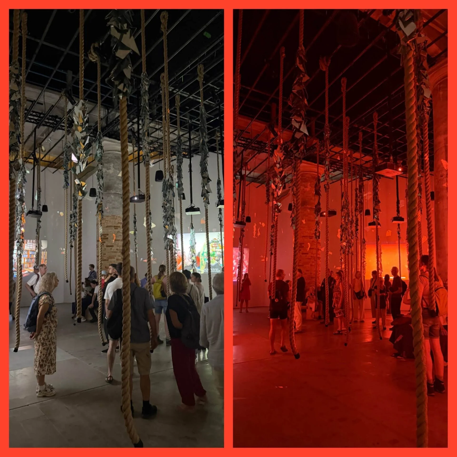
In Venice, I visited the Biennale at the Arsenale, the Giardini and various venues around the city. I also took the opportunity to see the Pinault collection at Punta della Dogana and a compelling exhibition by Michael Armitage at Palazzo Grassi.